
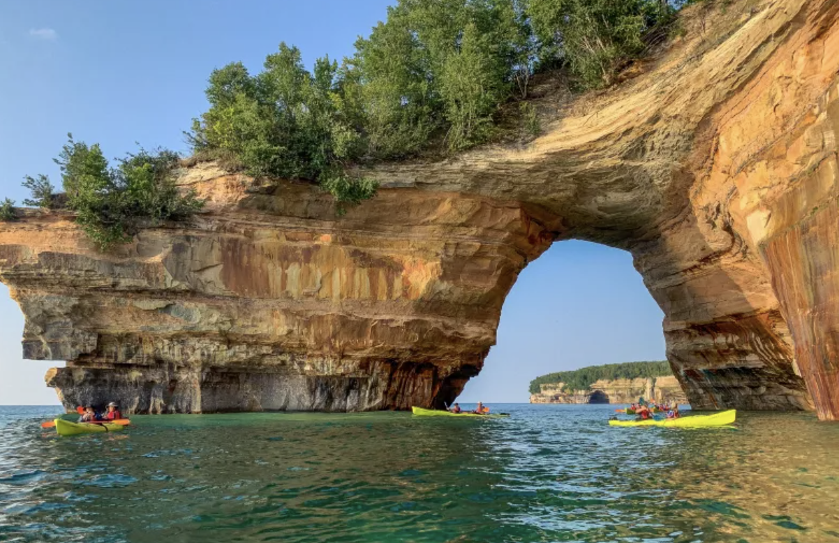
Pictured Rocks National Lakeshore is considered one of the most spectacular natural areas in the Midwest—42 miles of colorful sandstone cliffs rising dramatically above Lake Superior along Michigan’s Upper Peninsula. For those of us who love scenic drives, breathtaking shoreline views, and visits to National Park Service sites, this is a very special place, though the spectacular views are only accessible by boat!

We began our tour on the south shore of Lake Superior in the small town of Grand Marais (French for “Great Marsh”), often called the “Gem of the Upper Peninsula.” With a population of only about 300, Grand Marais serves as the eastern gateway to Pictured Rocks National Lakeshore.

Founded in the late 19th century as a lumber and fishing port, the town is known today for its rugged shoreline, maritime history, and nearby historic lighthouses. This is where the U.S. Lighthouse Service built a Light Station in 1874 to help guide ships safely along Lake Superior’s notoriously hazardous coast.
After spending a night in a cozy family-owned motel and enjoying breakfast at the Breakwall Restaurant, we set out on our 42-mile journey through this remarkable landscape.
Pictured Rocks was the first National Lakeshore authorized by Congress in 1966. Our visit combined two of the best ways to experience Pictured Rocks: hiking the trails above the cliffs and then taking the boat cruise below them. Each provided a completely different perspective.
The hike allowed us to experience the lakeshore up close and at our own pace.


The Water View
As impressive as the hiking was, the boat cruise added an entirely new dimension to our visit. We had seen the photographs—towering cliffs striped with colors, blue water, sea caves, beaches, and waterfalls—but nothing is like seeing it in person.

From the water, the cliffs revealed another dimension. The colorful mineral stains that give Pictured Rocks its name—reds, oranges, greens, blues, and blacks—were far more vivid than I expected. Over centuries, groundwater carrying different minerals has seeped through the sandstone, painting the cliffs in nature’s own palette.

The boat passed beneath massive formations sculpted by wind, waves, and time. There were lots of sea caves, arches, and towering rock faces… some formations looked like castles, others like Indian heads. Pics are in this video clip….
One overwhelming thing… the scale of the place! The photographs we have taken do not begin to capture how high the cliffs rise or how vast Lake Superior feels when standing at its edge. Looking out across the water, it often felt more like an ocean than a lake.
The sandstone itself is fairly plain-colored—the “pictures” are really a giant natural watercolor created by mineral-rich groundwater. Groundwater seeps through the sandstone cliffs, dissolves minerals, and then leaves colorful stains as it trickles down the rock face.
The spectacular colors come primarily from four minerals. Iron produces red, orange, and rust-brown; copper produces blue and green; manganese produces black and dark brown; and limonite produces white, cream, and yellowish-tan.

These mineral-rich waters have been staining the cliffs for thousands of years, creating the famous “painted” appearance that gave Pictured Rocks its name. The colors are continually renewed as groundwater emerges from cracks in the sandstone.
What made the cruise so memorable was the perspective. From above, the cliffs are beautiful. From below, they are awe-inspiring. By the end of the day, I understood why Pictured Rocks is often considered one of Michigan’s greatest natural treasures. The combination of colorful cliffs, pristine forests, endless views of Lake Superior, and opportunities for both hiking and boating created an experience that is difficult to match anywhere else in the Midwest.