
June 16-19. 2026
The North Shore of Minnesota is a spectacular stretch of the Great Lakes — a rugged, rocky shoreline along Lake Superior that runs from Duluth north to Grand Portage, MN, near the Canadian border. After our return from three nights on Isle Royale, we followed the North Shore Scenic Drive (Highway 61), south for about 150+ miles of cliffs, forests, waterfalls, small towns, and lake views. A few of our stops along the way:
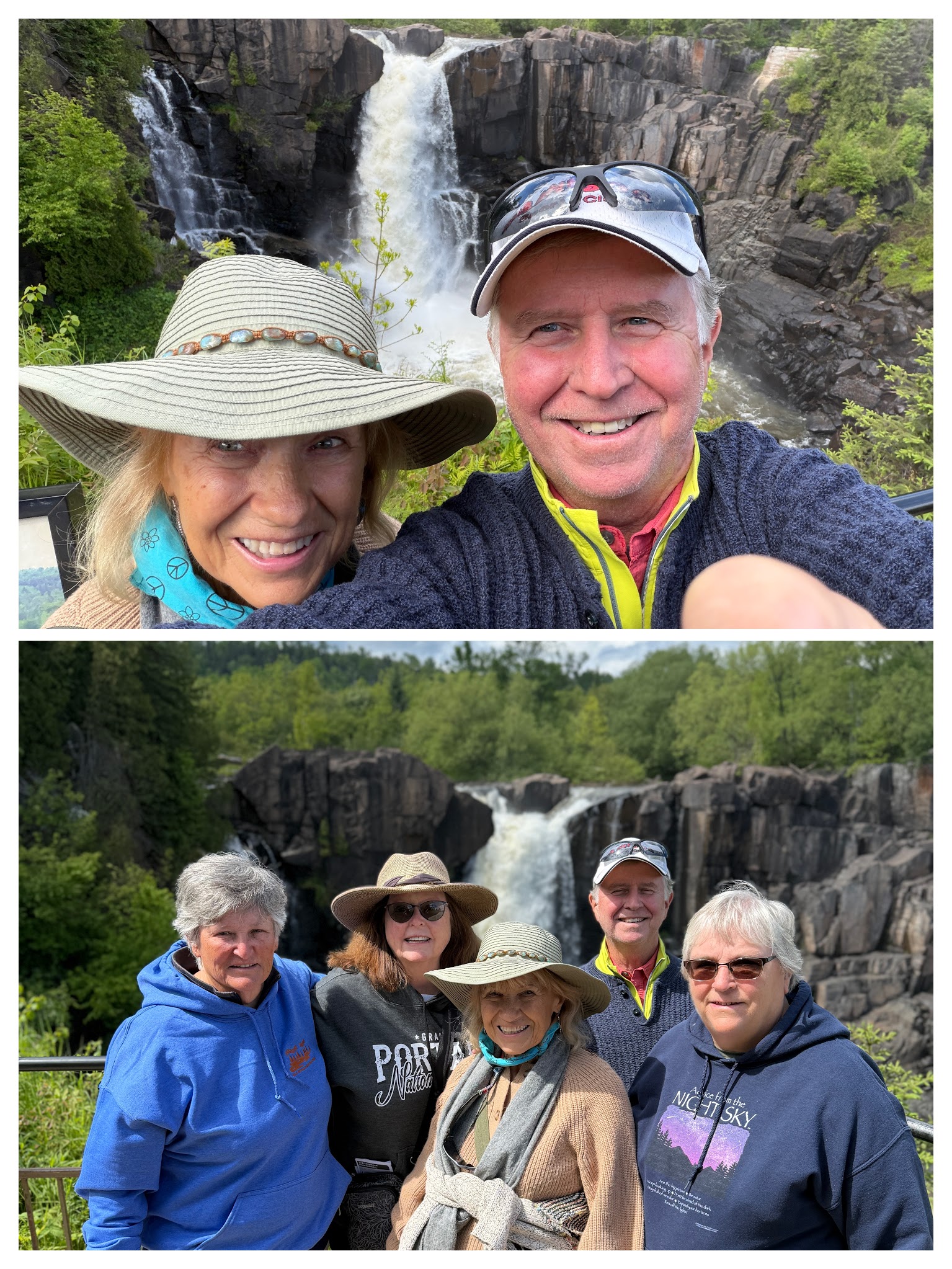
High Falls
High Falls of the Pigeon River is the tallest waterfall in Minnesota, dropping about 120 feet into a rocky gorge. The river itself forms part of the U.S.–Canada border, so we were actually looking across into Ontario.

It explains the name Grand Portage: the falls and rapids made canoe travel impossible, so Indigenous people and later voyageurs used a portage trail around them.

After a stop at the visitor center, we took an easy walk along a ½-mile paved trail from the visitor center to the falls, boardwalk, and viewing platforms.
It was a beautiful afternoon, and we even caught a small rainbow!

Grand Marais
I could never live here because of the cold, but Grand Marais seemed to be one of the most charming small towns on Minnesota’s North Shore. It sits about 110 miles northeast of Duluth, near the northern end of our North Shore Drive. The town surrounds a protected harbor formed by a natural bay and a breakwater, which leads to the iconic Grand Marais Lighthouse.

This area was originally inhabited by the Ojibwe people and later became an important stop during the fur trade era. Commercial fishing and logging helped build the town, and tourism gradually became its primary industry during the twentieth century.

With a population of only about 1,300, it serves as the jumping-off point for two of Minnesota’s greatest outdoor destinations: Boundary Waters Canoe Area Wilderness (one of the largest wilderness areas in the eastern United States) and Gunflint Trail, a 57-mile scenic road that heads into the heart of the North Woods.
We stopped for a great meal at the Angry Trout Café. The menu said this was herring…which I had only known to eat pickled! Our server told us that around Lake Superior, fishermen catch what is often called Lake Herring, a close relative of the Atlantic herring. It supposedly has a richer flavor than white fish and is very plentiful in the Grand Marais area.

Despite its small size, Grand Marais has an outsized reputation as an arts town. Our server at the Angry Trout told us about the North House Folk School, a nationally known center for traditional crafts. It draws students from across the country and teaches skills that range from boatbuilding and blacksmithing to timber framing. One of its instructors was recently part of the international team that helped rebuild the massive oak roof structure of Notre-Dame Cathedral in Paris after the 2019 fire.
They also run a sailing school…we saw their schooner take off while we were at the Angy Trout.

We had a great time wandering the small town. We were surprised to find a Ben Franklin store! The chain we grew up with once had 2,500 stores nationwide, but today there are only a handful of independently owned stores like this one!

BUT, these are no longer five-and-dime stores! We saw a Norwegian sweater for $1900 along with other upscale clothing, footwear, and camping equipment! Times have changed!!!!
Naniboujou Lodge
We stopped here just to admire the Cree Indian-inspired Art Deco design of the hand-painted murals. They are almost like walking into a dream — bright, geometric, colorful, and completely unexpected in a rustic Lake Superior lodge. The patterns mix Art Deco-era design with Indigenous-inspired imagery — a very 1920s interpretation of the North Woods.

Naniboujou was built as an exclusive private club for wealthy members. It opened in 1929, just before the stock market crash ended that dream. Famous names such as Babe Ruth and Jack Dempsey were associated with the early club.
The lodge used Indigenous themes as part of its romanticized “wilderness” image, reflecting how many places in that era borrowed from Native cultures without always involving Native artists or communities. Today, the murals are valued as historic artwork.

Steam Fog!
An unusual sight for us came after a rain shower. The rain fell onto pavement warmed by the day’s sun, creating ribbons of fog that hovered just above the road. I read that the phenomenon is known as steam fog and occurs when moisture evaporates from the warm surface and then condenses in the cooler air above. Whatever the science, it transformed an ordinary highway into something that looked like a scene from a mystery movie!

Cleveland-Cliffs Northshore Mining
We passed the Cleveland-Cliffs Northshore Mining, a taconite (iron ore) mining and processing plant. The iron ore, from mines inland on the Mesabi Iron Range (the huge iron ore mining region in northeastern Minnesota), is crushed and processed to concentrate the iron into small taconite pellets.

Those pellets are then shipped by rail or ship to ports like Duluth, where they are loaded onto the huge Lake Superior freighters. Then they are off to the steel mills via the Soo Locks, which we had visited earlier in Sault Ste. Marie, Michigan!

Some taconite continues on to the St. Lawrence Seaway, which we also visited on the 1000 Islands portion of this trip, reaching ports in Quebec or being transferred to ocean ships for export overseas.

It is fun to see how the places we have visited over the last five weeks are fitting together like puzzle pieces (even though we have been seeing the process in reverse!!) Even the story of the SS Edmund Fitzgerald’s sinking is tied to taconite, since it was carrying iron ore pellets from Minnesota when it sank.

Split Rock Lighthouse
Split Rock Lighthouse is a place that really ties together the lake’s beauty and its dangerous history. It sits on a 130-foot cliff above Lake Superior and is probably the most famous lighthouse on Lake Superior’s American shore.

The story began with the great Mataafa Storm of 1905. A fierce November storm battered Lake Superior, damaging or destroying nearly 30 ships and killing sailors. After that disaster, Congress funded a lighthouse and fog signal station on this stretch of the North Shore because ships carrying iron ore needed safer passage. The same cold, powerful lake that shaped the voyageurs, miners, fishermen, and sailors also created the need for this lighthouse

Construction itself was supposedly amazing: there were no roads to the site yet, and materials had to arrive by ship and be lifted up the cliff by cranes. The lighthouse was completed and first lit in 1910, and it remained in service until 1969, when modern navigation technology made it unnecessary.
The tower is only about 54 feet tall, but because it stands on that towering cliff, its light is visible far out over the lake. Like most of the lighthouses we have visited, it uses a French-made Fresnel lens that concentrates the light into a powerful beam.

Because of the renovation during our visit, some things were shrouded in nets and scaffolding.😂😂

We walked to the top of the lighthouse, which is now preserved as a historic site. The tower, keeper houses, fog signal building, and other structures have been restored, and there are docents for tours and questions. Each year on November 10, the light is traditionally illuminated in memory of the sinking of the SS Edmund Fitzgerald in 1975.


Our visit today was about a week before the completion of the rehab project. The preservation project is to protect the lighthouse structure — repairing masonry and addressing moisture/humidity issues caused by the harsh Lake Superior environment. So some of our pictures had to be gathered from websites! But still a good visit, and we have now been joined by our friends Mark and Ro, who drove up from Minneapolis!!!

Gooseberry Falls State Park
Our next stop on our journey along the North Shore was Gooseberry Falls State Park.

It had just the right combination of rushing water, ancient rock, towering trees, and the powerful presence of Lake Superior!
The Upper Falls is impressive — water pours over layers of dark volcanic rock formed from ancient lava flows that shaped this landscape over millions of years. The glaciers that later moved through this region carved the valleys and helped create the rugged North Shore we see today.

The highlight of the park is the series of waterfalls created by the Gooseberry River as it tumbles through a rocky gorge toward the lake.

The Upper, Middle, and Lower Falls are all easy to reach with short walks, making it easy to experience the scenery without a strenuous hike—which was good for our group of seniors with various knee and foot problems!
Gooseberry Falls also carries a piece of history. Many of the park’s beautiful stone structures and trails were built by the Civilian Conservation Corps during the 1930s. Their craftsmanship blends so naturally into the landscape that it feels like the park has always been this way.


What made Gooseberry Falls special was its accessibility… in just a short visit, we could see waterfalls, explore a river gorge, enjoy a Lake Superior overlook, and experience the character of Minnesota’s North Shore!


Lutzen
For two nights, we enjoyed a VRBO in Lutzen, MN, located along the rugged, wind-swept North Shore of Lake Superior. It was surrounded by the volcanic peaks of the Sawtooth Mountains and the Superior National Forest, and is apparently a year-round haven for Midwestern adventurers. It holds the proud distinction of being the birthplace of Minnesota’s resort industry. In 1948, an old V8 combustion engine powered the area’s first ski lifts, bringing downhill skiing to the state for the first time.


Pete remembers skiing here (the largest and highest ski resort in the Midwest) many years back with daughter Pam! Its 95 runs and 1,000-foot vertical drop offer vistas overlooking Lake Superior. No snow today, but we were able to walk to the gondolas from our lovely accommodations. This place was a perfect wilderness escape… We took it easy, played the game Five Crowns, and enjoyed the time together.

The name “Lutsen” pays homage to the Battle of Lützen (1632), a milestone in the Thirty Years’ War involving Sweden’s King Gustavus Adolphus… cementing the town’s deep-rooted Scandinavian immigrant heritage! I knew someone who attended the college by the same name… located south of Minneapolis. Now I understand where the unusual name is derived!

Duluth
Duluth seemed to be the point in the trip I felt were either entering or departing the “north woods” and the vast Lake Superior region.
Located on the western tip of Lake Superior, Duluth combines the feel of a working port with that of an outdoor adventure town. With about 87,000 residents, it’s Minnesota’s fourth-largest city and the gateway to the famous North Shore of Lake Superior.
1800’s Duluth…
In the late 1800s and early 1900s, Duluth became one of America’s boom cities. It was the gateway between the rich iron ore deposits of Minnesota’s Mesabi and the steel mills of the Great Lakes. Iron ore was king at that time; much of the steel that built America’s railroads, skyscrapers, bridges, automobiles, and ships began its journey through Duluth.
As a result, Duluth was the nation’s busiest ore port. For decades, more iron ore passed through Duluth than any other port in the world. Mining fortunes were enormous (like today’s high-tech people!) Entrepreneurs, mine owners, railroad executives, and shipping magnates amassed incredible wealth. Between 1900 and 1920, Duluth ranked among the wealthiest cities in the country, with an extraordinary concentration of millionaires relative to its size.
Memories of our 2016 trip to Duluth…….
Families built grand mansions that still stand today. One was the 39-room Glensheen Mansion that we visited in 2016,

along with the luxurious Cotton Mansion (now a B&B) where we stayed for a night.

There are others reminders of that golden era that we can see today….the massive ore docks, the Aerial Lift Bridge, and the city’s iconic landmarks and historic downtown buildings that were financed by mining and shipping fortunes.
This city, with only about 100,000 people today, once played such an outsized role in the industrial growth of the United States.
Canal Park

Once filled with warehouses, Canal Park has become the city’s most popular destination. We strolled through the area and were lucky enough to catch a ship leaving the harbor.


This was funny….as we were walking in Canal Park, it was of those Déjà vu moments! Pete looked back through our 2016 photos, found my picture (on the left), and we replicated the 2026 pose!


The Aerial Lift Bridge

The city’s iconic landmark, the Aerial Lift Bridge, spans the ship canal connecting Lake Superior to Duluth Harbor.

When a large freighter approaches, the bridge rises to let it pass—a spectacle that locals and visitors alike stop to watch!

We were fortunate to see this ship slip under and away!


Enger Tower

Enger Tower sits high above Duluth. It is an 80-ft stone observation tower built in 1939 that offers one of the best “big picture” views of the Twin Ports of Duluth and Superior, WI, Lake Superior, and the surrounding hills.
The tower is really a story about Bert Enger, a Norwegian immigrant who came to Duluth, became successful in the furniture business, and gave generously to the city. When he died in 1931, he left land and money that helped create what became Enger Park. He wanted ordinary people to enjoy the land and the view — not just wealthy residents. The tower became a memorial to him.
The dedication in 1939 was a major event: Crown Prince Olav and Crown Princess Märtha of Norway attended. That was a meaningful moment for Duluth’s large Norwegian immigrant community. Decades later, Harald V and Queen Sonja of Norway returned in 2011 for the rededication following restoration.
We climbed the stairs to see Duluth’s harbor, Lake Superior stretching out like an ocean, Superior, Wisconsin, and the hills and forests inland.


The tower is only part of the visit: there is also a beautiful Japanese Peace Garden with a Peace Bell and Picnic areas.

Enger Park turned out to be one of those stops that required very little effort but delivered a tremendous reward.

Duluth was a delightful visit the second time around!! This was also the end of our drive along Minnesota’s North Shore. Now…off to the Apostle Islands of Wisconsin!
